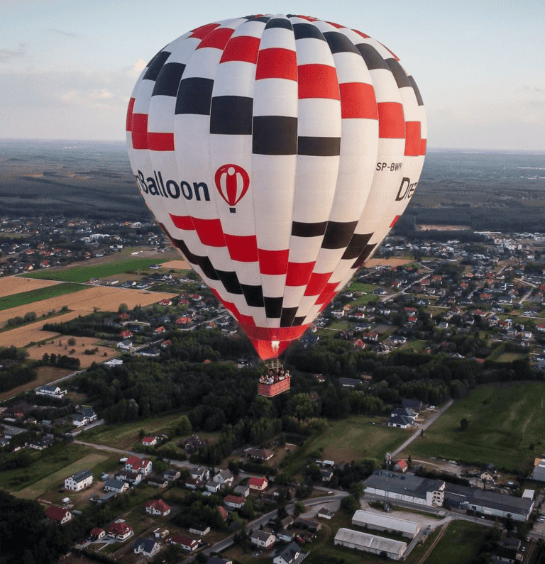
Following several phone calls we received this morning after canceling flights in Szczecin and the Tricity area, we’d like to share a few words of explanation.
Northern Poland is currently under the influence of high pressure and beautiful weather, with warm temperatures. It might seem that all the conditions are perfect for a balloon flight — whether in the evening or early morning. However, for a balloon pilot, the key factor isn’t sunshine or warmth — it’s the wind speed.
Usually, at this time of year, even if daytime winds are strong, they calm down shortly before sunset — allowing us to perform a safe flight and a smooth landing. But there are days when the wind doesn’t calm down — and sometimes even picks up right before evening. This is due to a specific pressure system, described by our Belgian colleague Lyssens Dirk — whom we’ll quote below (using automatic translation).
We encourage you to read the full explanation, book another date, and contact us if you have any questions. We’ve added plenty of new flights to our calendar — we’re sure you’ll find one that suits you perfectly.
Quote:
How is it possible that balloon flights are cancelled despite such beautiful summer weather?
We’re often asked why people haven’t seen many hot air balloons this year.Well, for the past few weeks, we’ve been experiencing frequent and strong north-eastern winds. The reason is a high-pressure area that has been stationary over the region of Scotland for quite some time. In weather forecasts, you might sometimes hear the term ‘omega block’ — meaning the system has become “locked” in place. Pressure systems determine our weather, and if these systems remain unchanged for a long time, we’ll experience the same weather conditions for an extended period. That’s what a “block” means.In the current situation, we’re lucky to have “beautiful” weather — but unfortunately, it’s too windy for balloon flights. On weather maps, you can see isobars — lines connecting areas of equal air pressure. Differences in pressure create wind. In areas where isobars are close together (indicating large pressure differences), the wind is stronger. In recent weeks, we’ve had a strong north-eastern wind caused by the high-pressure system over Scotland that extends into our region. Unfortunately, this strong wind often makes balloon flights impossible.So how does an omega block form? To understand this, we need to take a closer look at a phenomenon known as the jet stream. It is a very strong wind at high altitudes (between 9 and 14 kilometers), reaching speeds of up to 400 km/h. This tube-shaped current flows from west to east and is caused by temperature differences between the North Pole and the Equator. The jet stream sometimes bends, and in these bends, areas of high and low pressure form. Such a bend can remain in the same position for several days.By the way, the jet stream is also very important for aviation — airplanes often use it to save fuel when flying with strong tailwinds. It also played a key role in ballooning: record-breaking attempts to fly around the world in the 1990s in Rozière balloons took place within the jet stream (famous balloon pilots like Wim Verstraeten, Bertrand Piccard, and Brian Jones all used it).The term “omega block” comes from the Greek letter Omega (Ω) — the air flow moves from west to east, forming a curve that resembles the shape of this letter.